Cooling the City,
The Role of Impervious Surfaces and Open Space in Urban Heat
Fall 2024
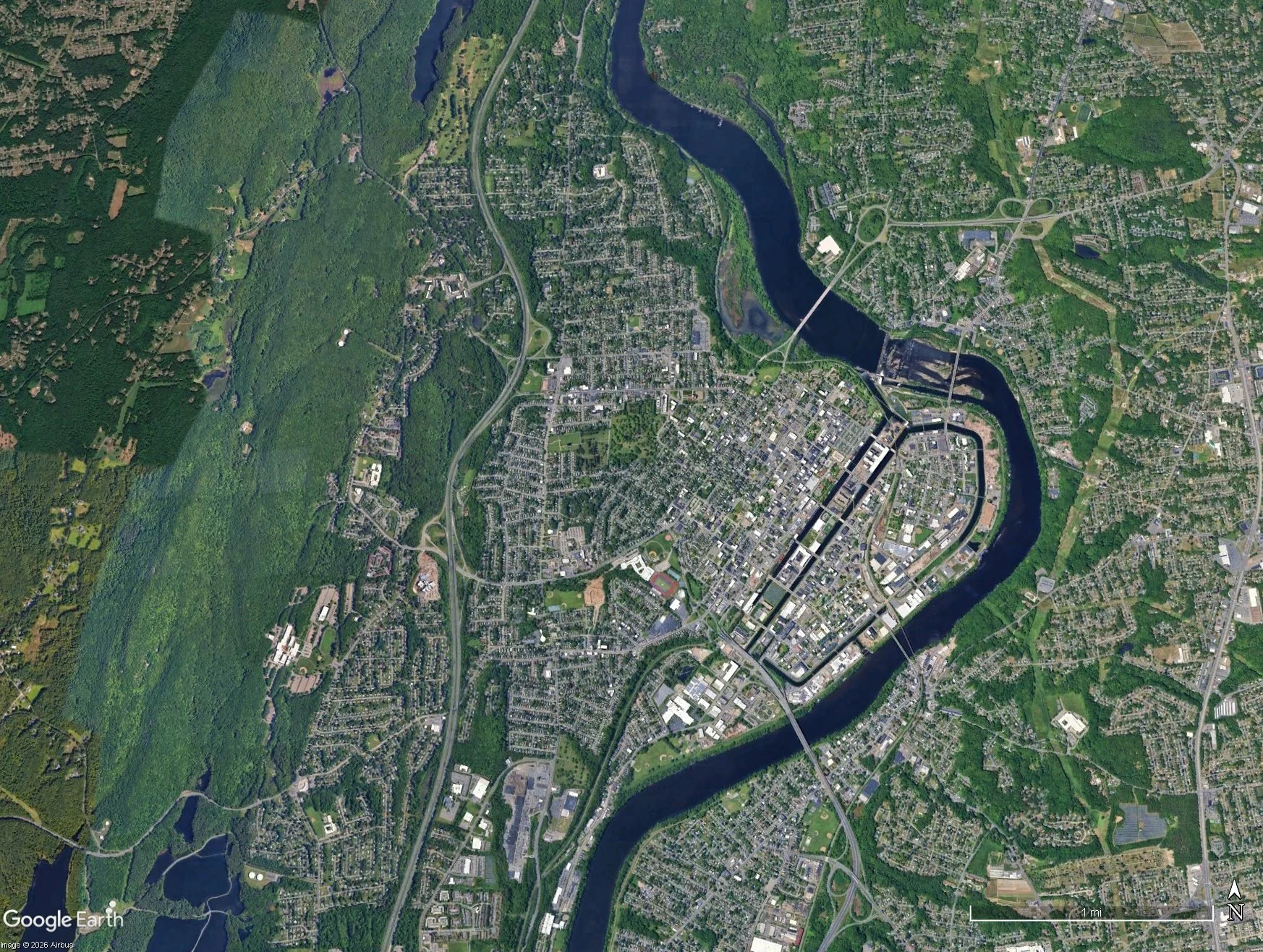
Holyoke, Massachusetts, a city with a rich industrial heritage, is characterized by a grid layout and numerous mill buildings that reflect its past. However, like many dense urban areas, Holyoke faces extreme summer heat exacerbated by impervious surfaces such as roads, sidewalks, parking lots, and rooftops. These surfaces absorb and retain heat, driving up temperatures and intensifying the urban heat island effect. In contrast, open spaces such as parks and green infrastructure offer critical benefits: they reduce heat, absorb stormwater, and promote physical and mental well-being.
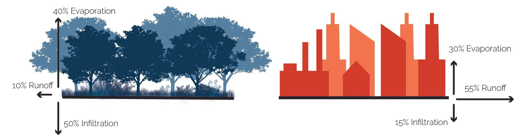
Natural Ground Cover
75% Impervious Surfaces
This project explores the relationship between heat intensity, impervious surface coverage, and open space distribution in Holyoke. Using GIS analysis, the study identifies spatial patterns of impervious surfaces and open spaces, investigating how they impact heat in different neighborhoods. To analyze the urban heat island effect in Holyoke, Massachusetts, this study will employ a combination of GIS-based spatial analysis and data visualization techniques.
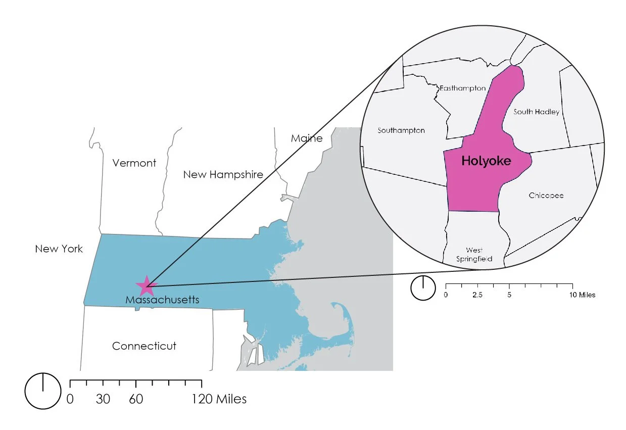
Holyoke, Massachusetts Context
Holyoke, Massachusetts Towns
Holyoke, Massachusetts, United States
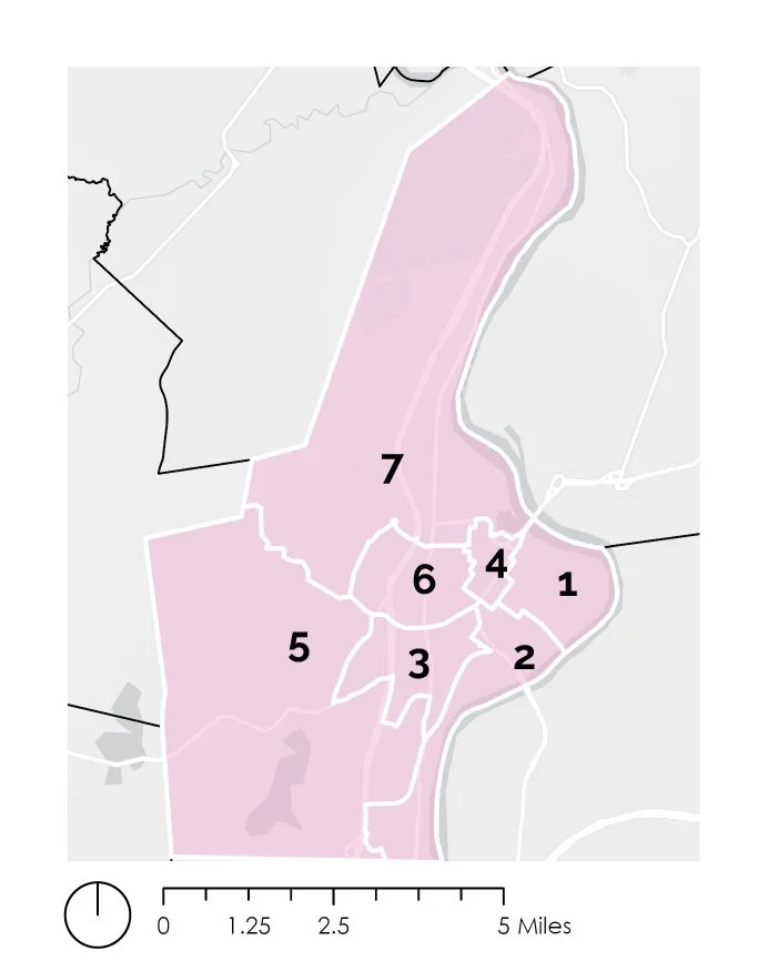
Located in western Massachusetts along the Connecticut River, Holyoke is a post-industrial city shaped by its historic relationship with the river and canal system. The city is divided into seven wards, each with distinct neighborhoods and patterns of development. These maps provide a regional and local context for understanding the city and the areas explored throughout this GIS analysis.
Holyoke Wards
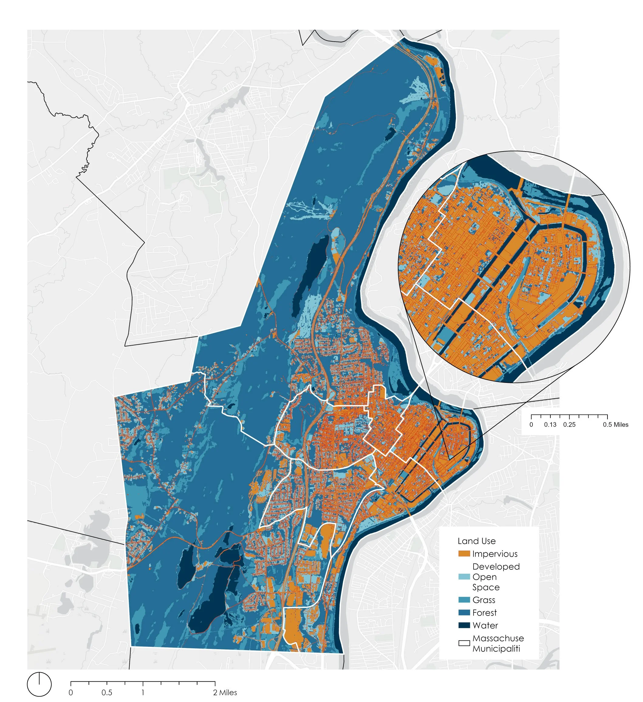
Impervious Surfaces VS Open Space
This analysis focuses primarily on impervious surface coverage across Holyoke, with additional analysis of Ward 1. Because Ward 1 is not the city’s most densely populated ward, further analysis of other wards would be needed to identify areas where high population density and impervious surface coverage overlap. The findings are also dependent on the quality and availability of the GIS data. While the heat imagery used in the analysis is from 2023, it may not reflect more recent changes in development, land cover, or vegetation.
Limations
Next steps
Future work could evaluate underused parking lots and other paved spaces to identify opportunities for permanent or temporary green interventions, such as pocket parks and small shaded gathering spaces. Expanding green infrastructure through green roofs, walls, and increased tree planting could further reduce the impacts of impervious surfaces and urban heat. Protecting and maintaining existing trees and green spaces will also be essential to improving climate resilience while creating healthier, more comfortable places for residents to live, gather, and connect with nature.
The analysis reveals a significant difference in impervious surface coverage between Holyoke as a whole and Ward 1. Approximately 18% of the city is covered by impervious surfaces, while approximately 70% of Ward 1 is impervious. Although Holyoke has substantial areas of green space, including Mount Tom State Reservation and other natural areas, these spaces are not evenly distributed throughout the city. Ward 1 is much more densely developed, with limited green space and fewer opportunities for residents to access it. This concentration of pavement and buildings can contribute to increased heat and highlights the importance of expanding accessible green spaces within densely developed neighborhoods.
Results
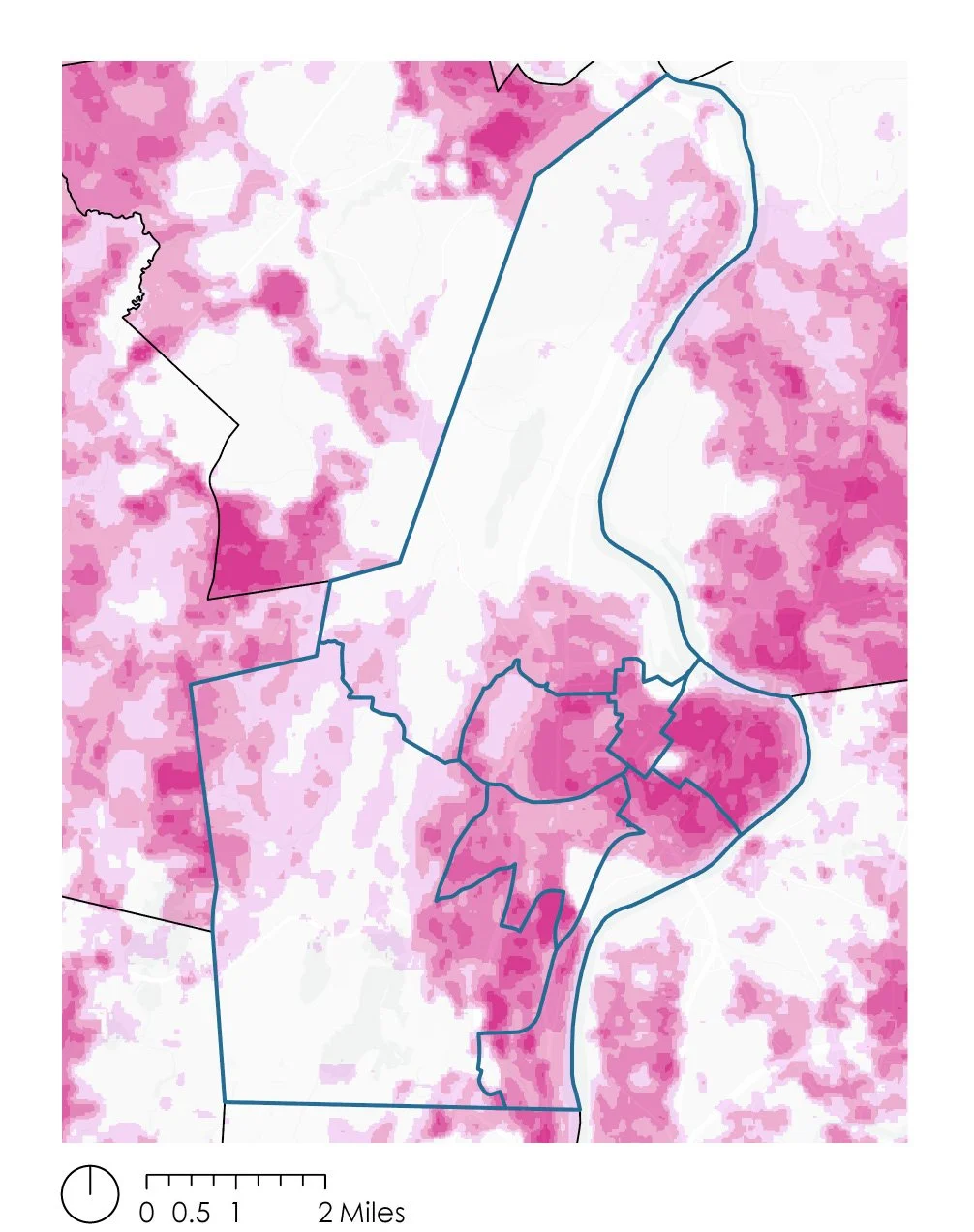
Heat Distribution
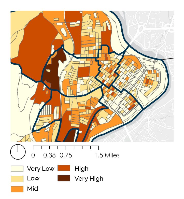
Population Density
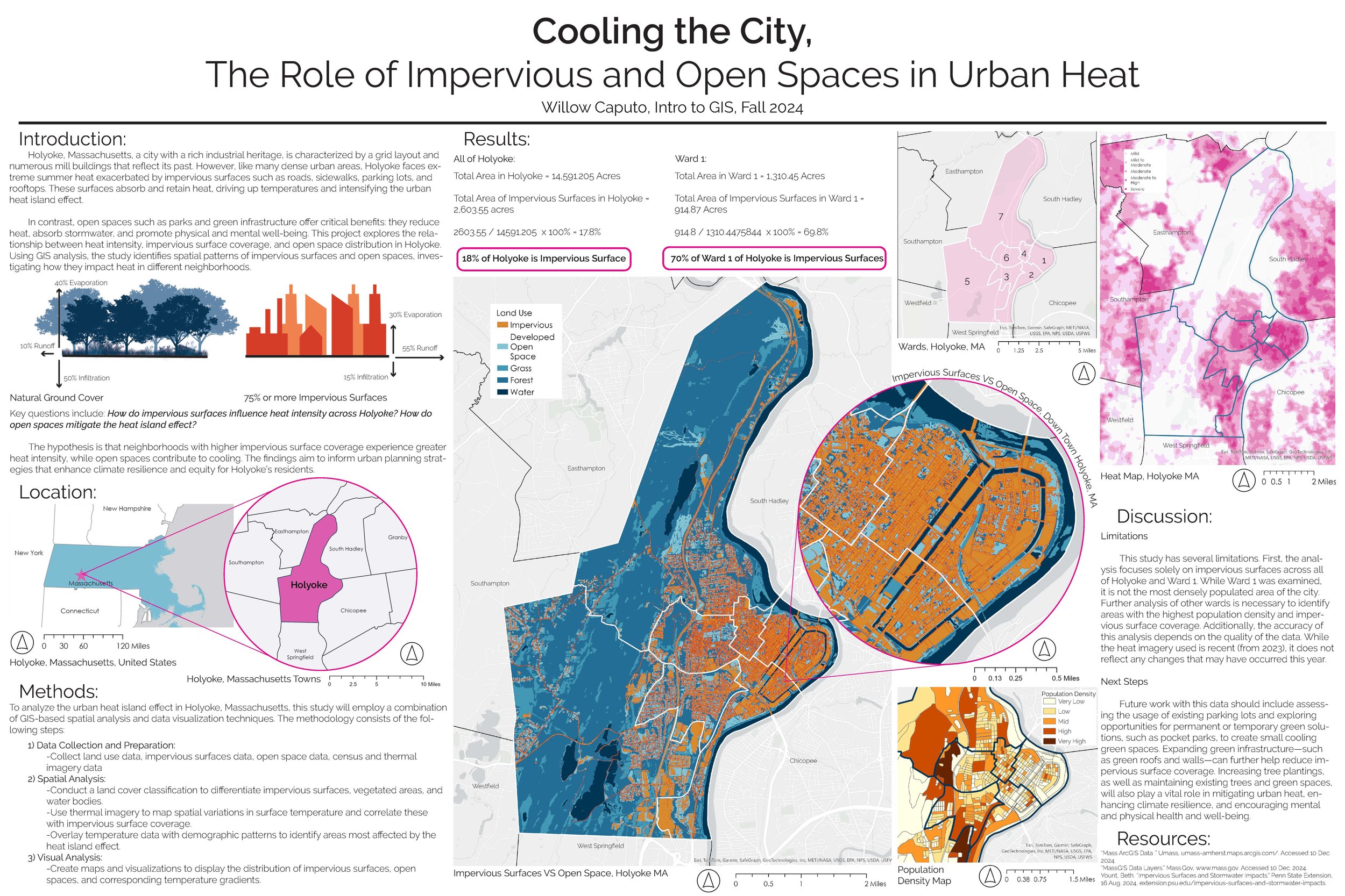
Final Poster