River Resilience in Bangkok, Thailand
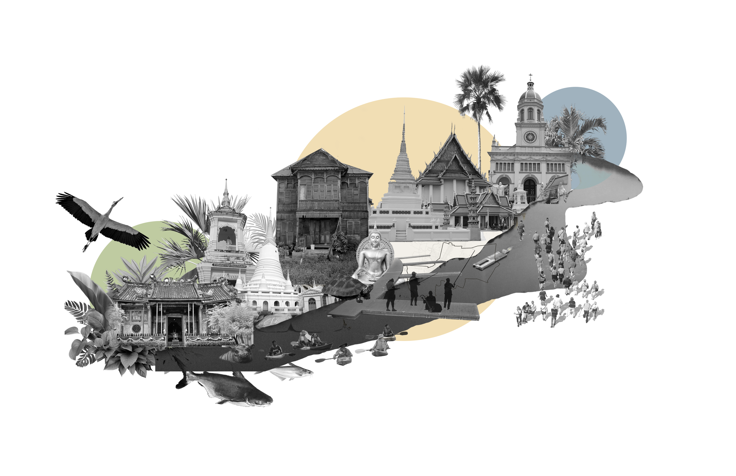
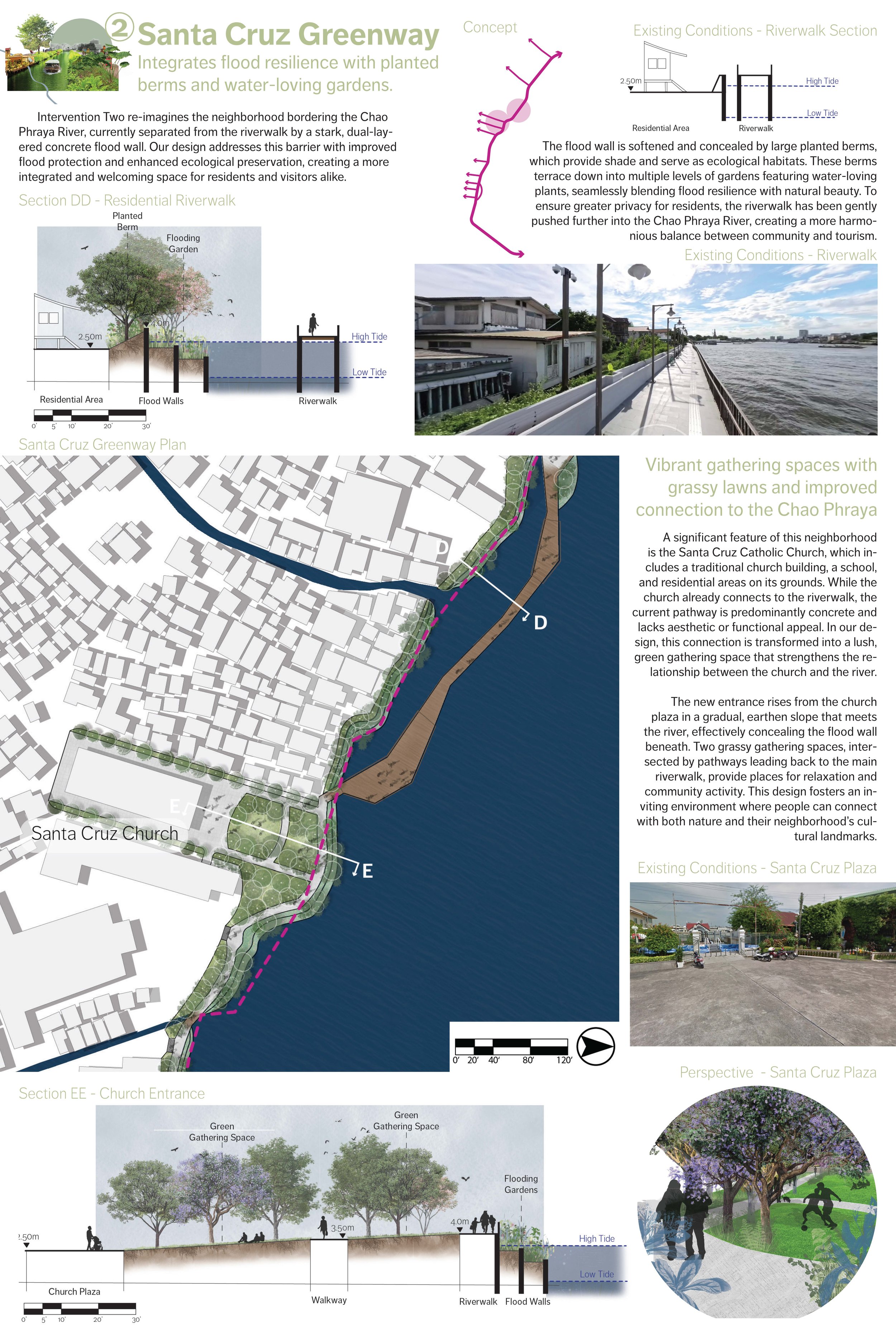
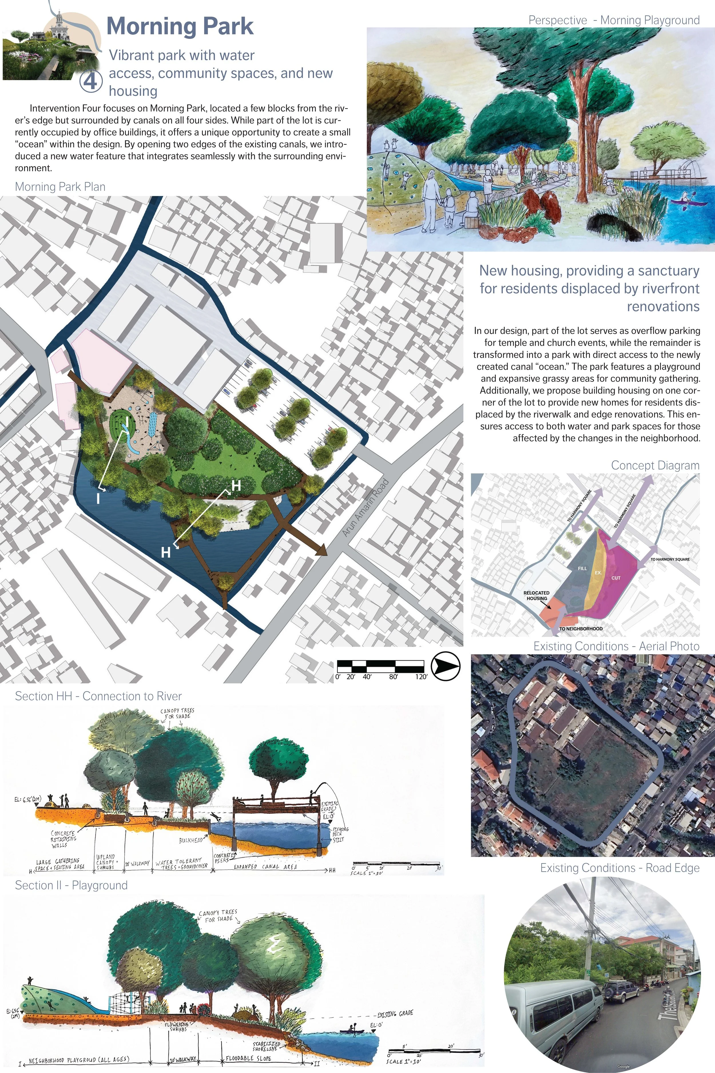
In collaboration with fellow student Nolan Fonda, we developed a riverside resilience project aimed at creating recreational spaces for the adjacent community in Bangkok Thailand while mitigating the impacts of climate change like, rising sea levels, increased flooding and extreme weather. These issues are further intensified by dense urban populations and extensive impervious surfaces.
The Chao Phraya River experiences daily tidal fluctuations of up to three meters (approximately 10 feet), equivalent to the height of a basketball hoop. The current government plan proposes constructing a flood wall along both sides of the river to protect against flooding. However, this approach isolates people from the river, severing their connection to an essential natural and cultural resource.
Fall 2024
Master Plan
Existing Conditions
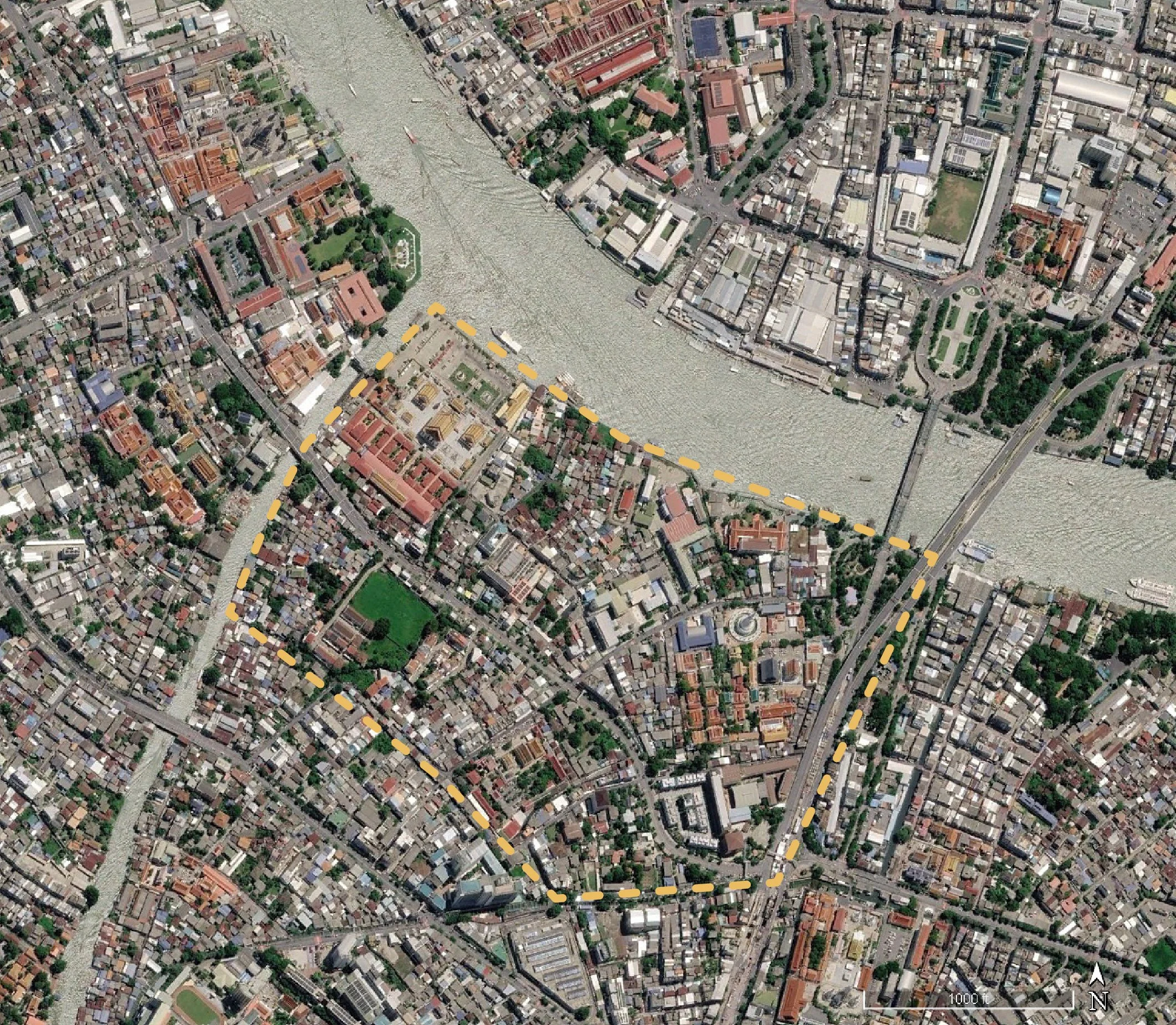
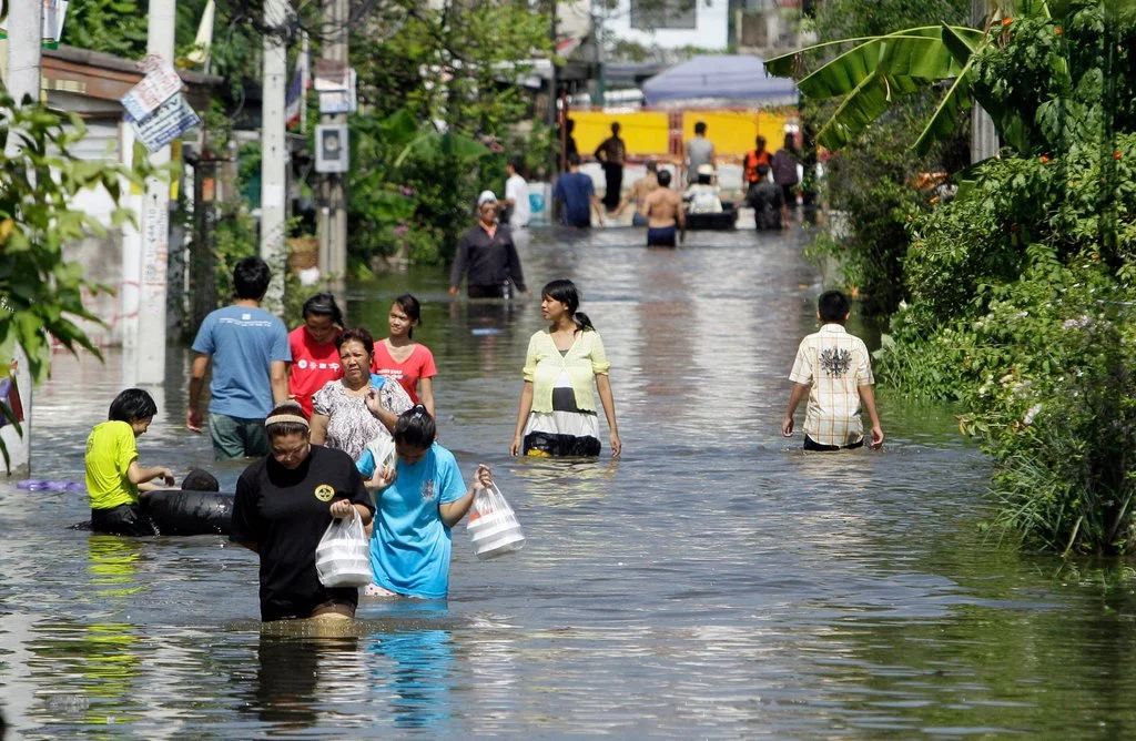
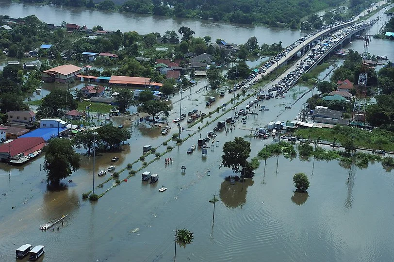
Located along the Chao Phraya River in Bangkok’s historic Kadeejeen neighborhood, the project site sits within a city deeply shaped by its relationship with water. Much of Bangkok is low-lying and vulnerable to flooding during heavy storms and periods of high water. The floods of 2011 and 2021 demonstrate the ongoing challenges faced by communities along the river.
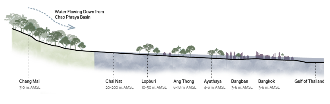
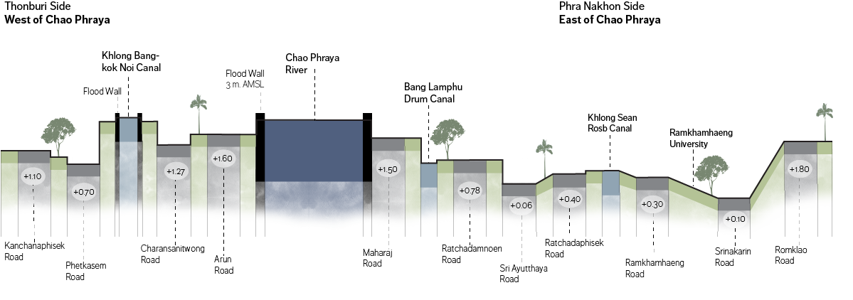
The sections illustrate how the surrounding landscape gradually slopes toward the river, directing water into these low-lying areas and highlighting the need for landscape strategies that work with water rather than simply resist it.
In response, we developed four landscape architecture intervention plans, two of which are included here. All graphics were made with a combination of Auto CAD, Adobe Illustrator, Photoshop, and hand drawing.
1. Harmony Square
A multifunctional space for gathering recreation and play.
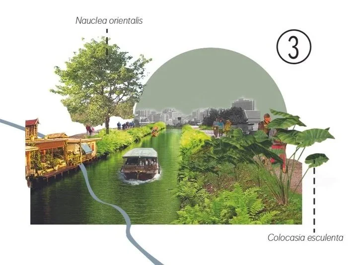
2. The Riverside Link
A flood resilient landscape integrating planted berms and water absorbing gardens.
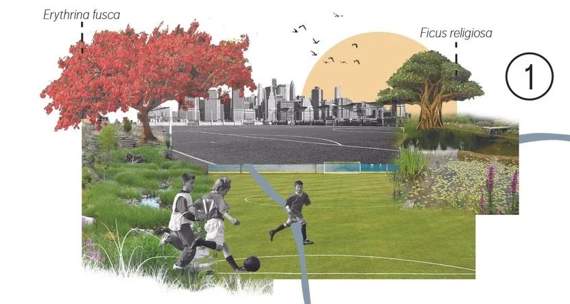
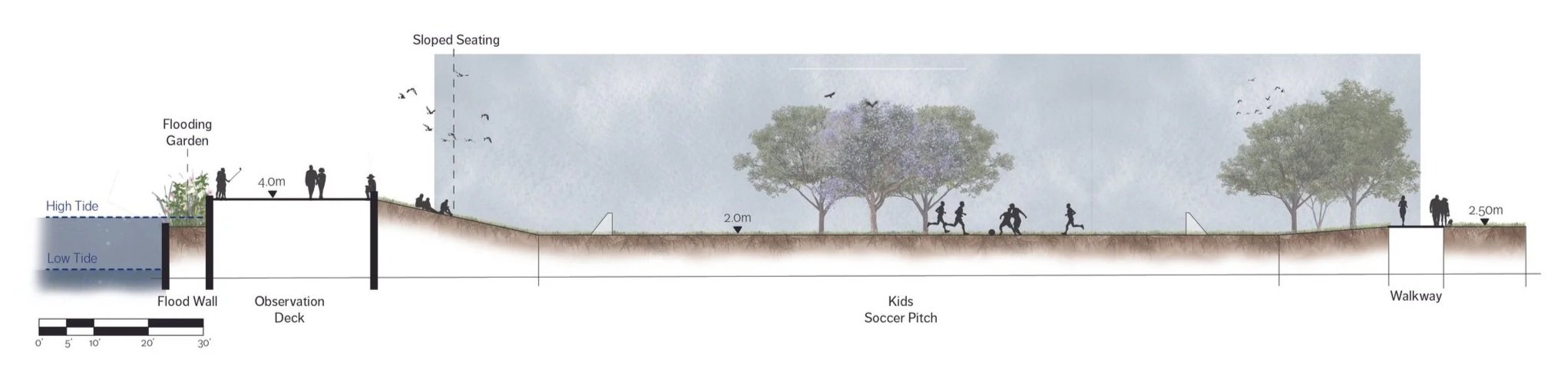
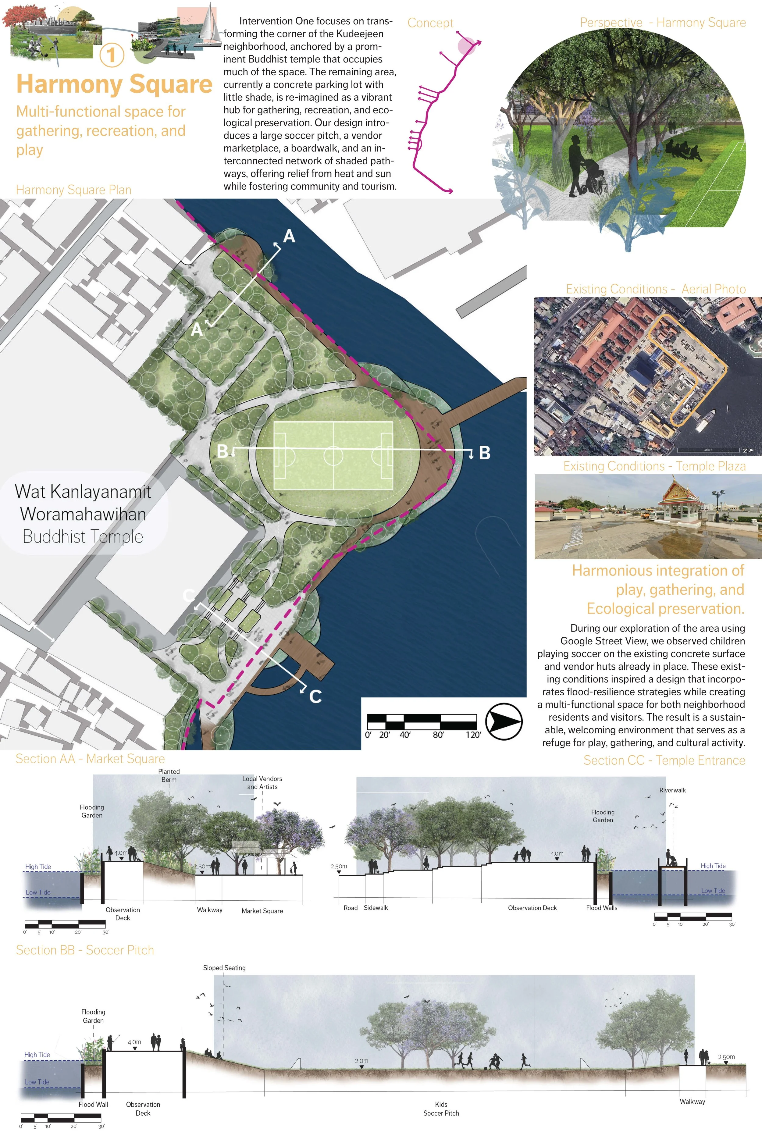
Harmony Square is located at the corner of the Kadeejeen neighborhood, currently a Buddhist temple and large parking lot with minimal shade. Using Google Street View, we observed children playing soccer and vendor huts already in place, inspiring our design.
Harmony Square
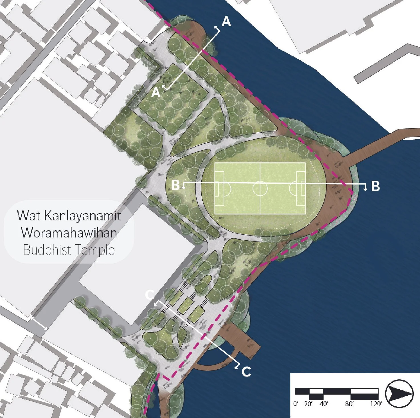
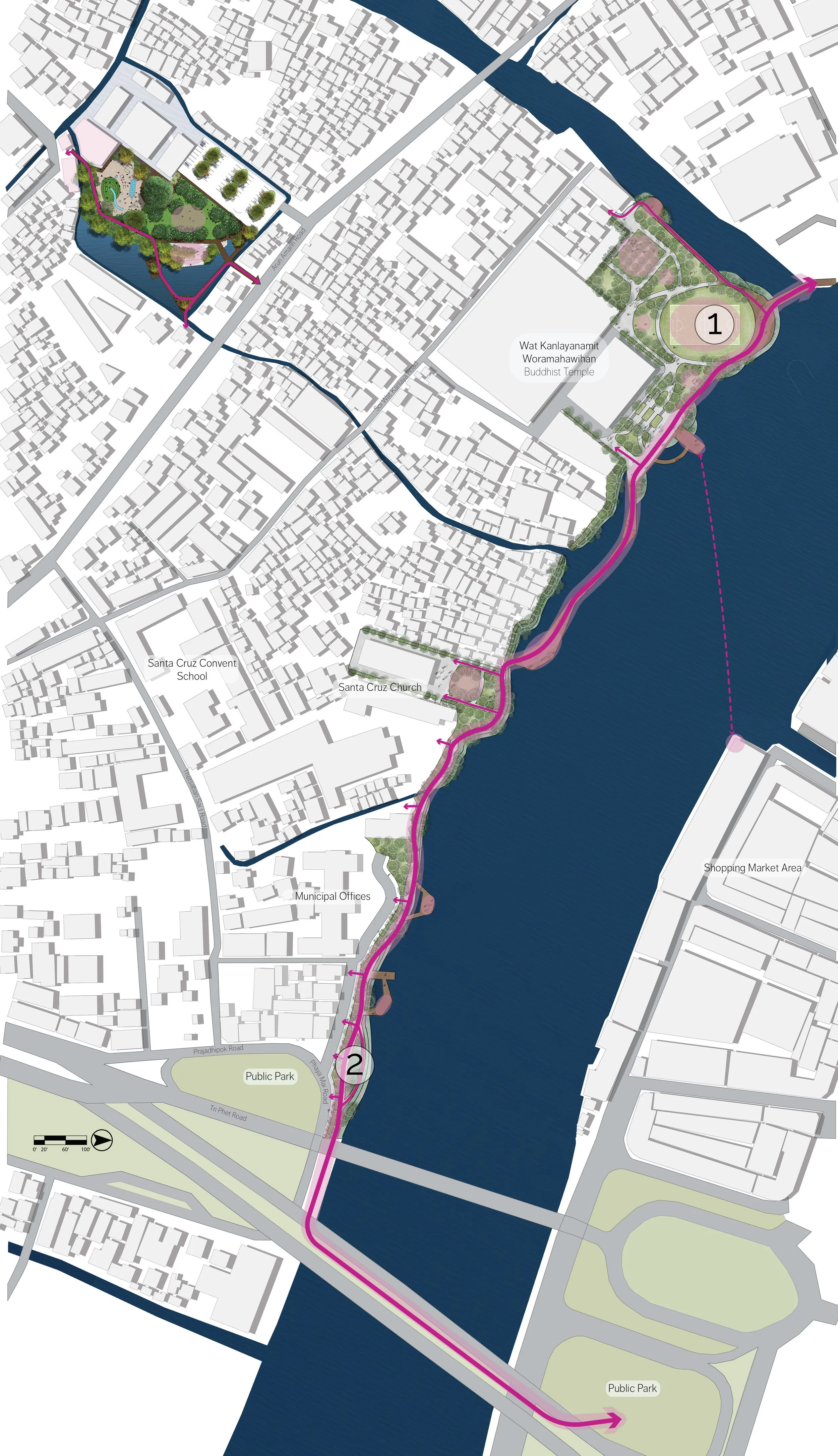
Our plan transforms the existing site into a multifunctional riverfront space centered around recreation, gathering, and cultural connection. A soccer pitch, shaded marketplace, and open grassy areas provide flexible spaces for play, community events, and everyday use, while a new boardwalk extends the riverwalk and connects the site to the nearby fort. Pathways weave through the site and connect the temple to these key destinations, creating a more accessible and cohesive public landscape.
Flood resilience is integrated throughout the design. With an existing ground elevation of approximately 2.5 meters and high tide reaching 3.0 meters, the site edges were elevated to 4.0 meters to provide additional protection from rising water. Together, these strategies create a resilient and welcoming riverfront landscape that can support recreation, community gathering, and cultural activities while adapting to Bangkok’s relationship with water.
Harmony square plan
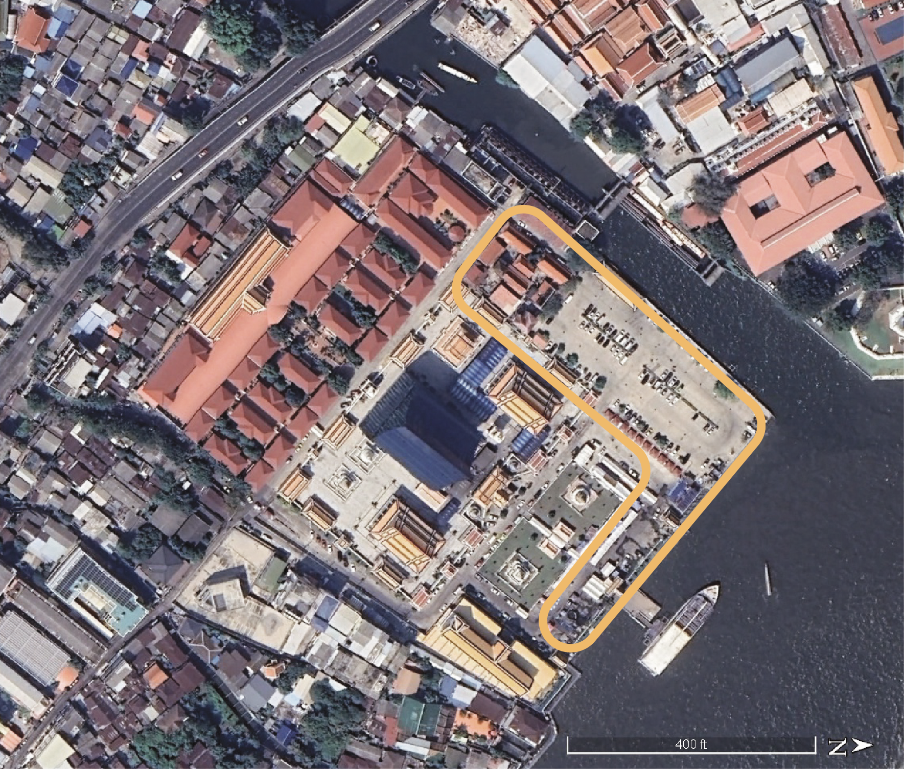
Existing Conditions
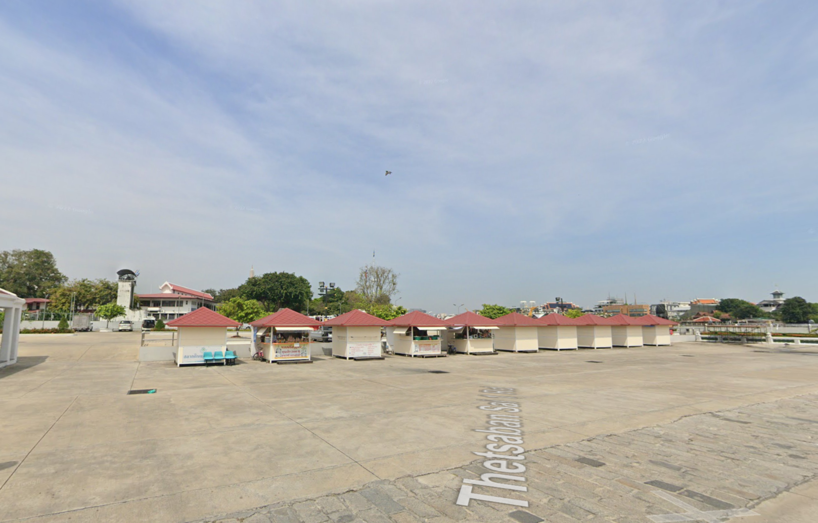
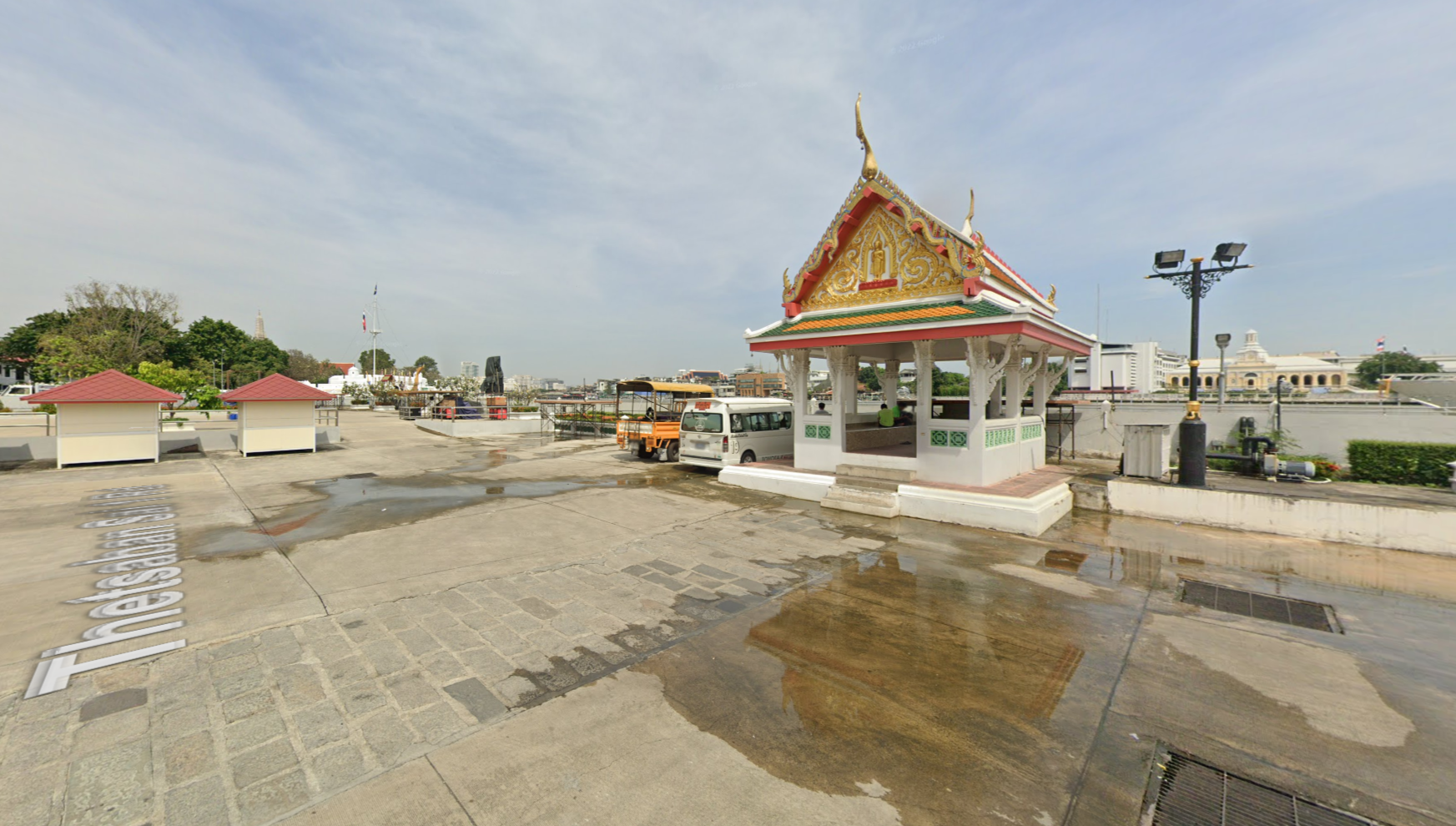
The first intervention site is a large, open parking area along the riverfront, currently occupied by small vendor huts and informal gathering spaces. Despite its location overlooking the Chao Phraya River, the site has very little vegetation or shade, leaving much of the space exposed to the heat. The expansive paved area presents an opportunity to create a more comfortable, green, and welcoming connection between the neighborhood and the river.
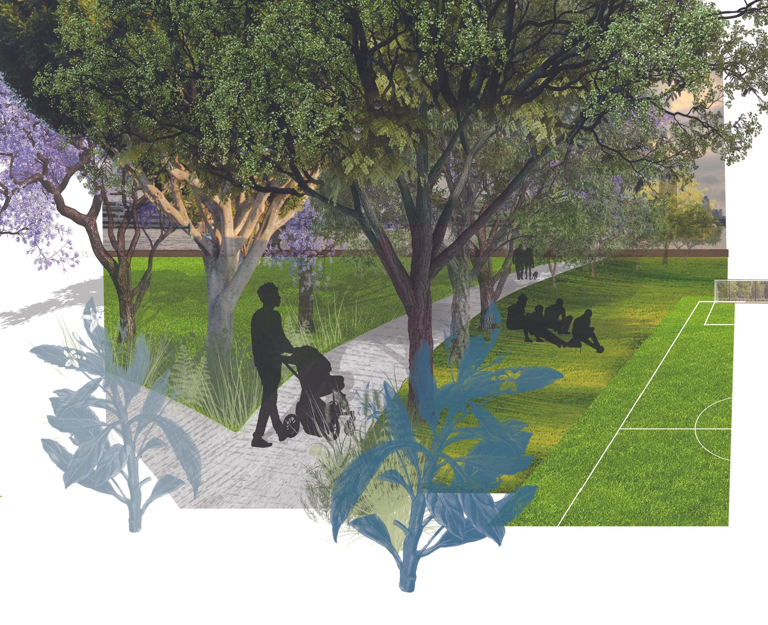
perspective
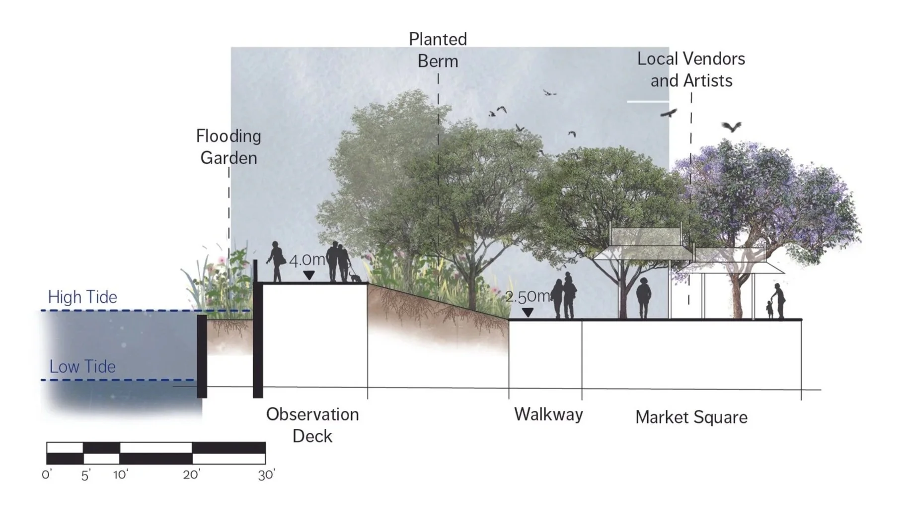
Section a
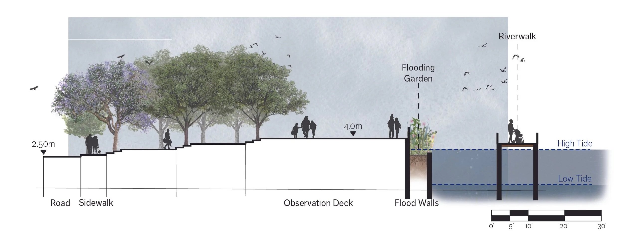
Section b
Section b
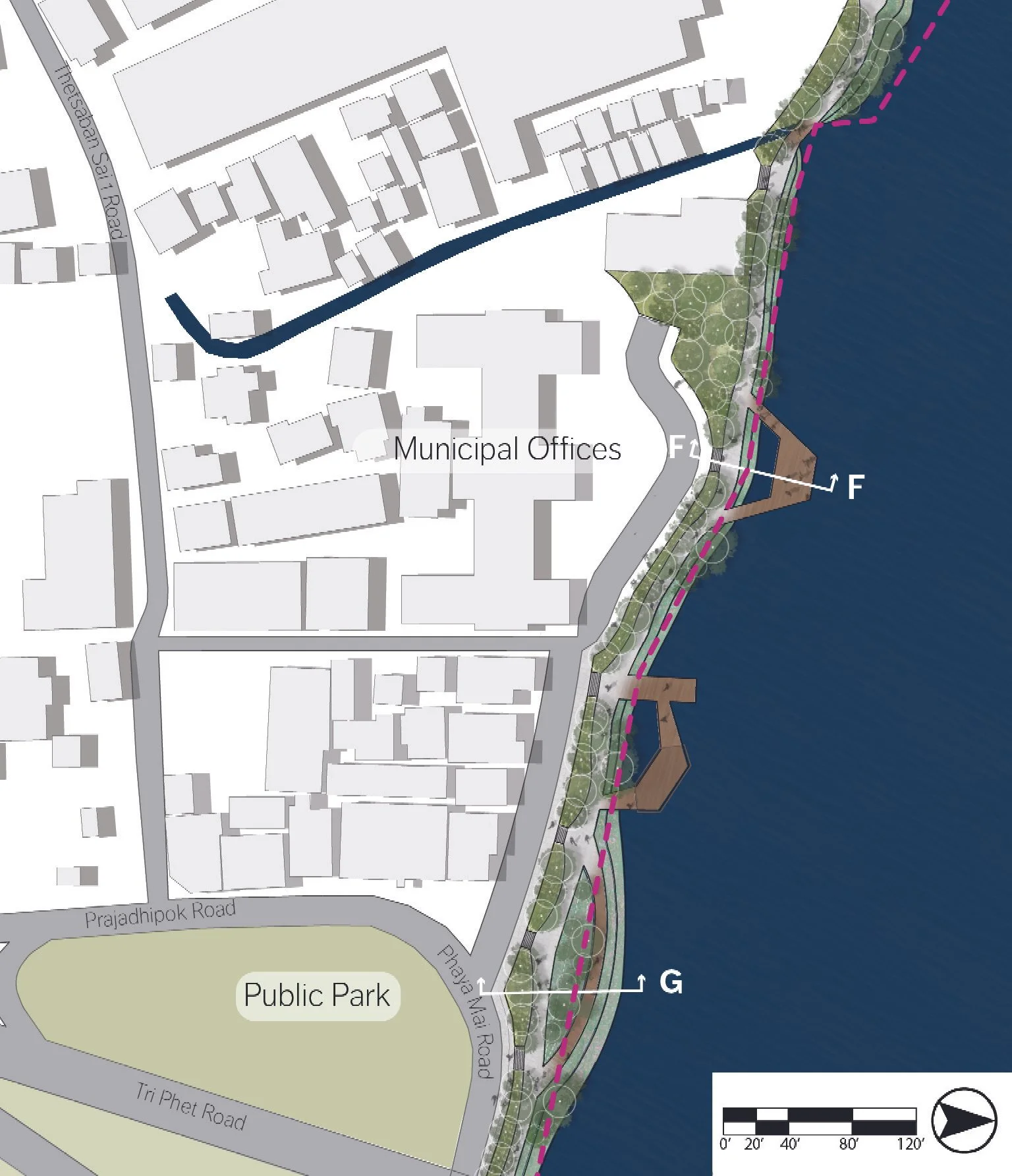
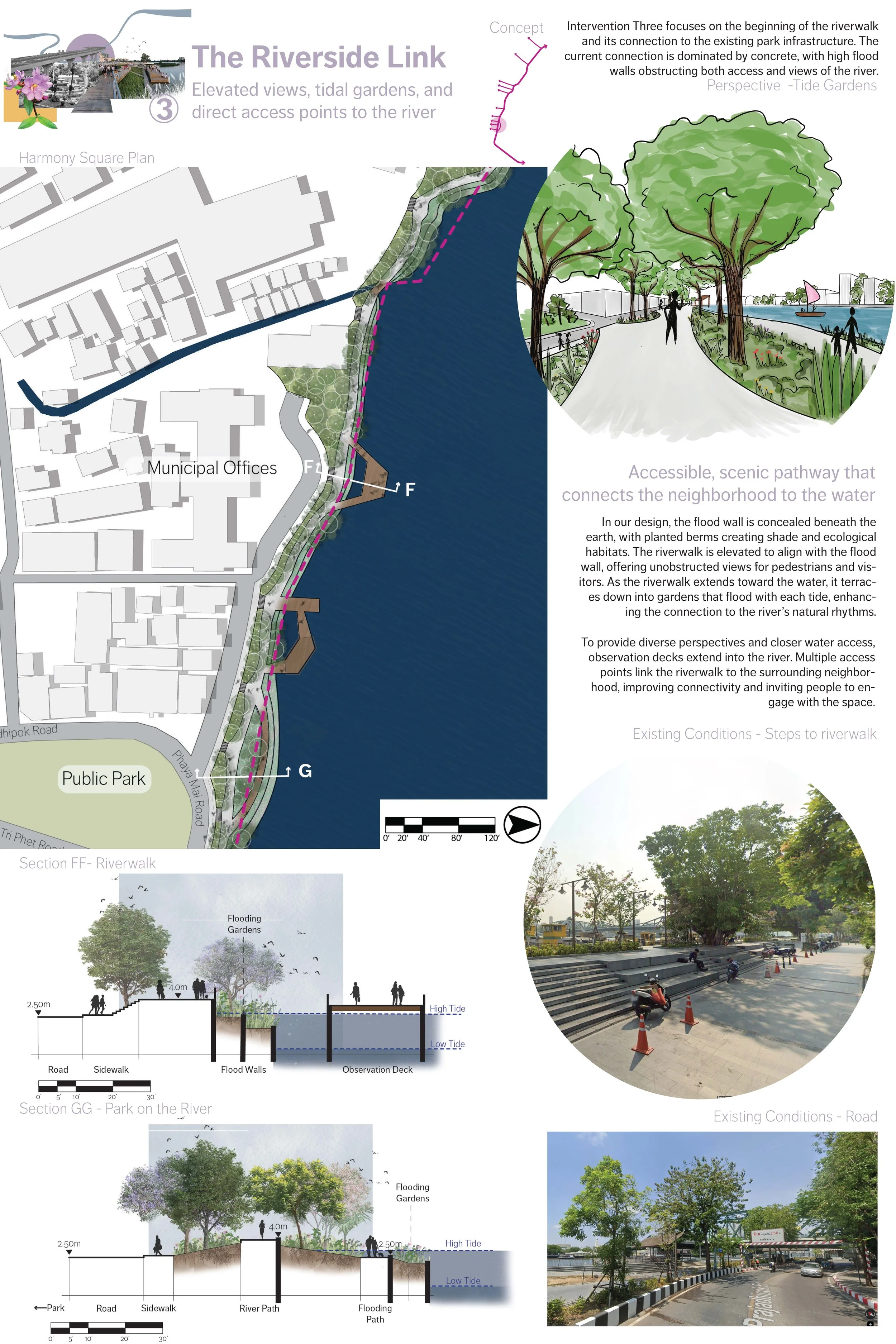
Intervention Two focuses on the beginning of the riverwalk and its connection to the existing park infrastructure. The current connection is dominated by concrete, with high flood walls obstructing both access and views of the river.
The riverside link
Section f
Section G
Riverside Link Plan
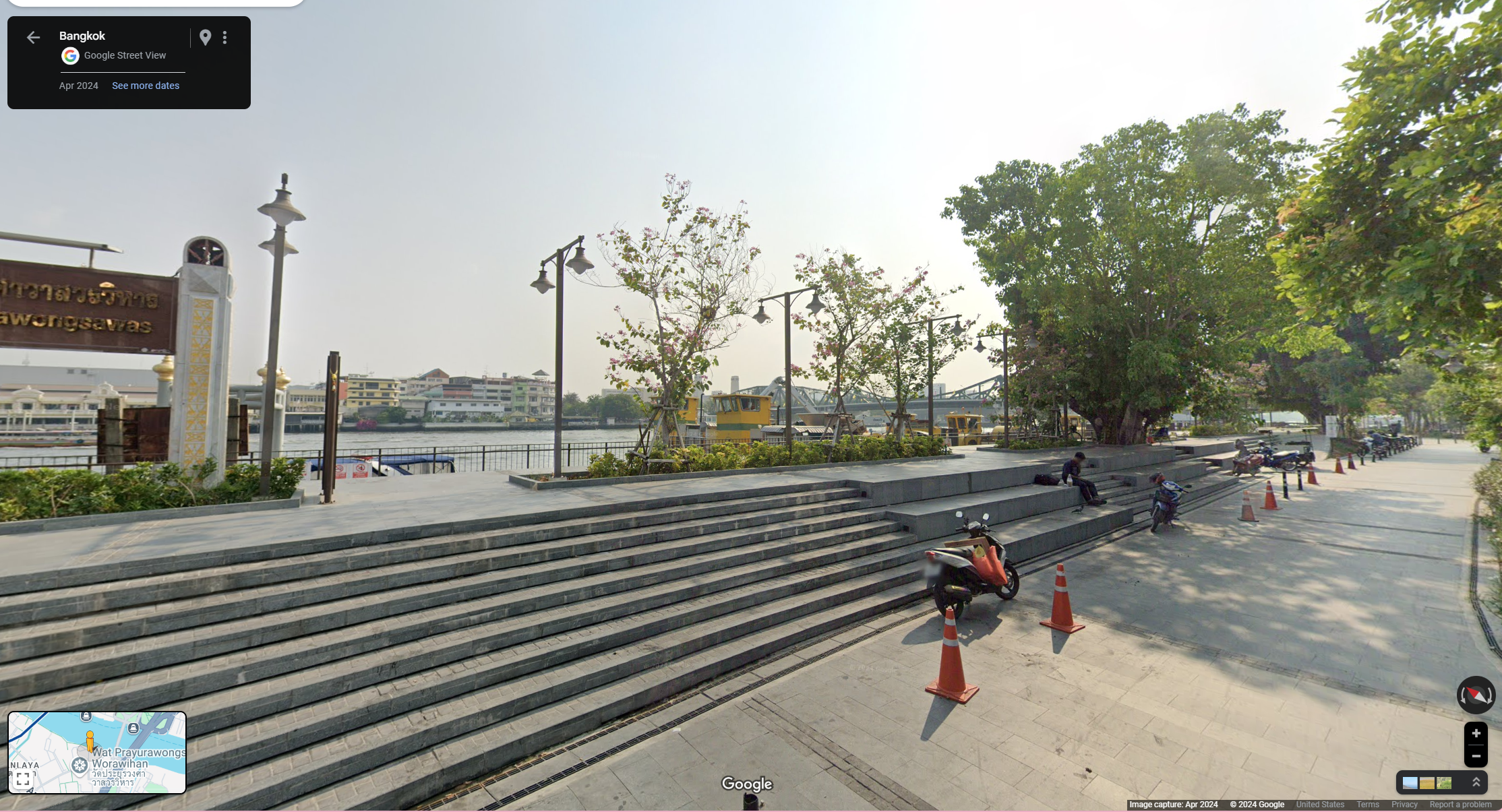
Existing Conditions
The second intervention area sits at the end of the existing riverwalk, where the waterfront path meets an existing public park. A flood wall runs along the river’s edge, creating a strong physical and visual boundary between the neighborhood and the water. While the riverwalk provides access to the waterfront, the transition into the park is limited, creating an opportunity to strengthen connections between the river, public space, and surrounding community.
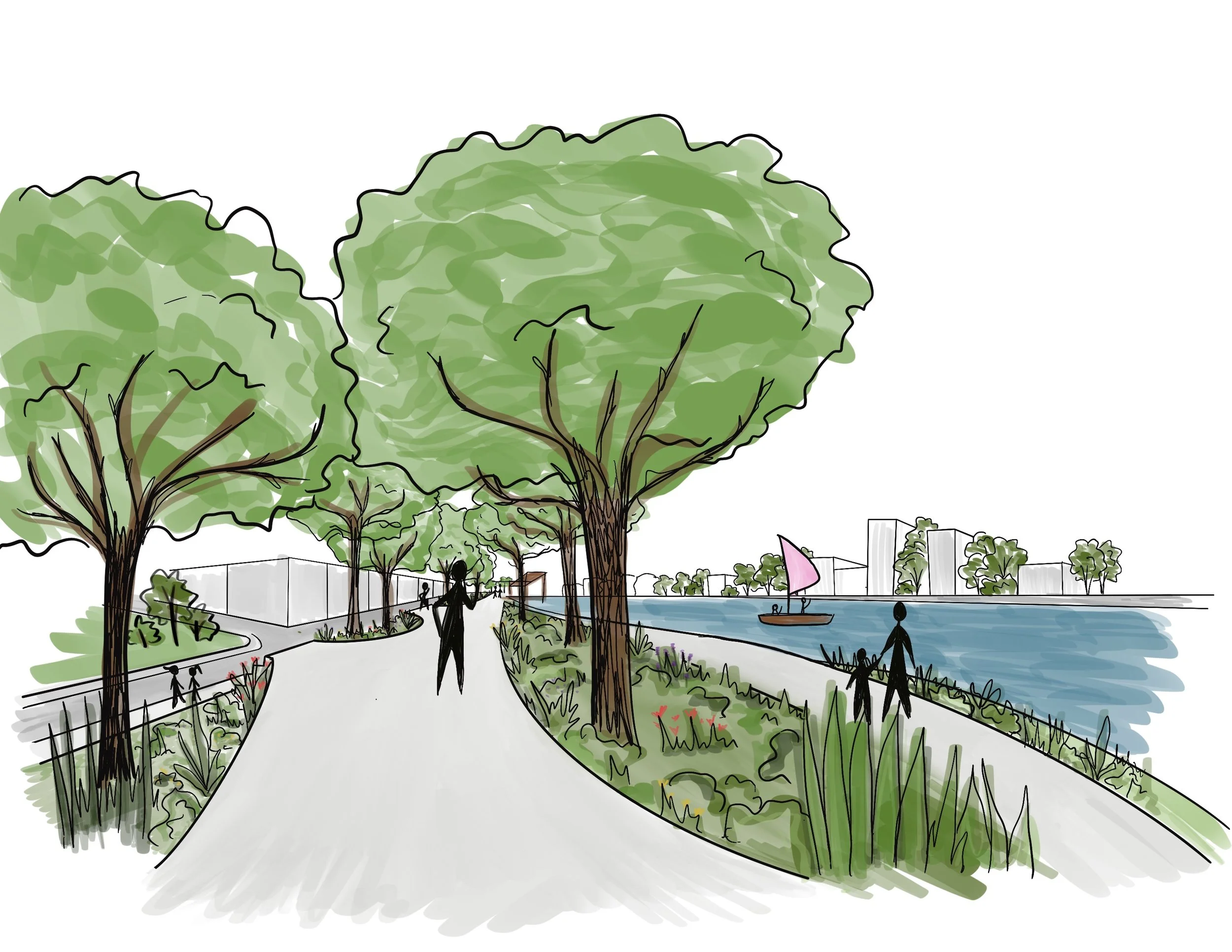
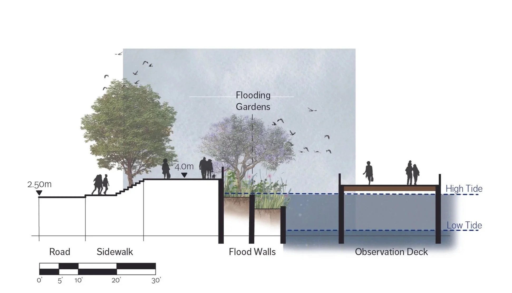
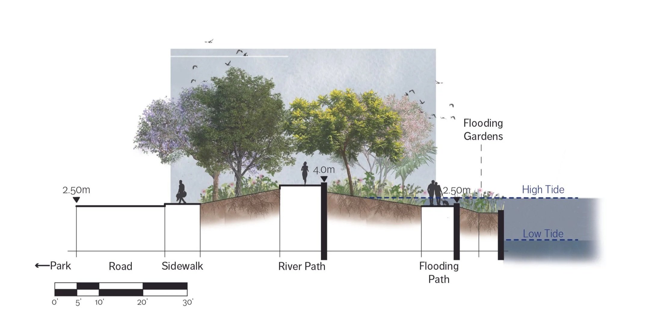
In our design, the flood wall is concealed beneath the earth, with planted berms creating shade and ecological habitats. The riverwalk is elevated to align with the flood wall, offering unobstructed views for pedestrians and visitors. As the riverwalk extends toward the water, it terraces down into gardens that flood with each tide, enhancing the connection to the river’s natural rhythms.
To provide diverse perspectives and closer water access, observation decks extend into the river. Multiple access points link the riverwalk to the surrounding neighborhood, improving connectivity and inviting people to engage with the space.
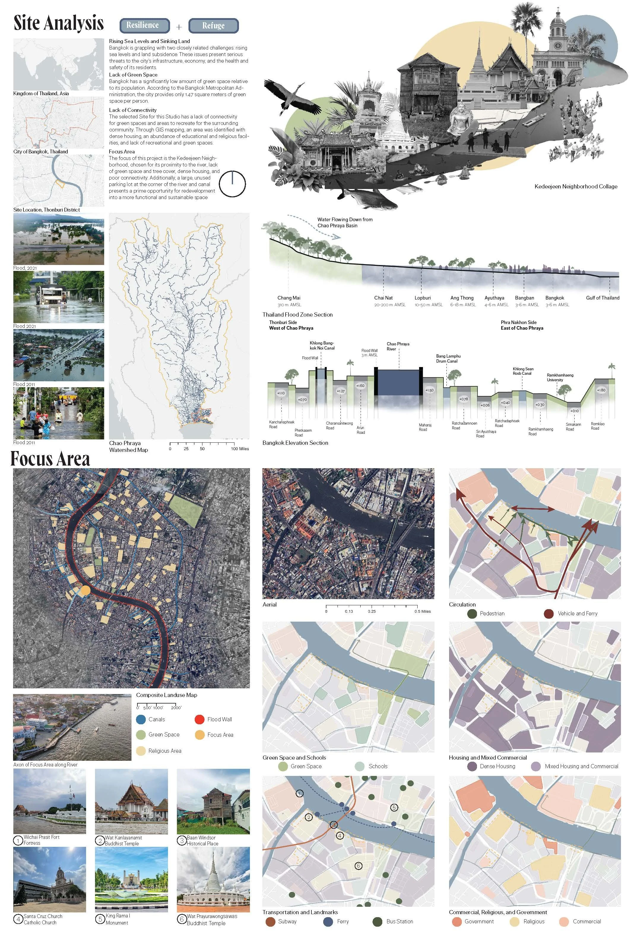
Site Analysis P1
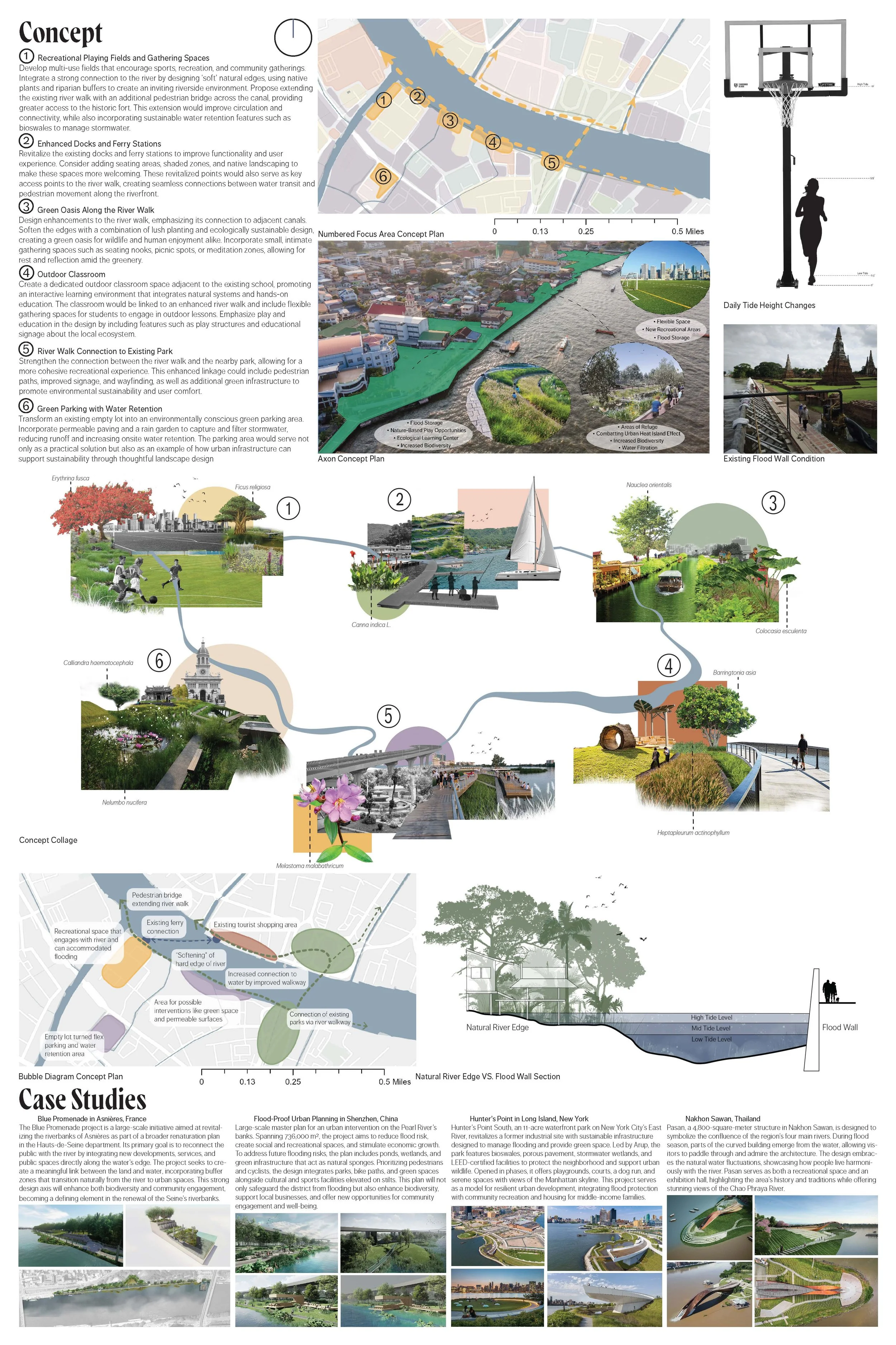
Site Analysis P2
Final Design P1
Final Design P2
Final Design P3
Final Design P4